Calgary sits on a mix of glacial till, gravel terraces, and bedrock from the Paskapoo Formation. Below downtown, the water table sits around 10 to 15 meters deep. These conditions shape how seismic waves travel through the ground. A proper site response analysis helps predict amplification effects specific to each site. We combine borehole data with geophysical testing to build a reliable ground model. For projects in areas with soft clay layers, we often recommend a complementary MASW survey to measure shear wave velocity profiles directly. This data feeds directly into the site class definition required by NBCC 2020.
A site response analysis can reveal localized amplification factors that change the design spectrum by up to 40 percent.
Methodology and scope
Calgary experiences an average of one to two magnitude 5 earthquakes per century in the broader region. The 2001 magnitude 5.3 event near the Montana border was felt across the city. Site response analysis accounts for local geology, not just epicentral distance. We follow a structured process: gather existing subsurface data, run field geophysics, and perform one-dimensional wave propagation modeling. Key parameters include VS30, fundamental site period, and amplification factors. For deeper soil profiles in the river valleys, we incorporate microtremor HVSR measurements to capture the natural resonance frequency of the site. These results are then cross-checked against available strong motion records from other Canadian sites.
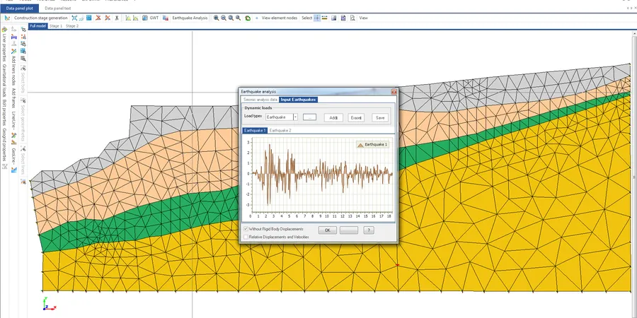
Technical reference image — Calgary
Local considerations
What we see most often in Calgary is that engineers assume a uniform Site Class C for the entire property. That is rarely accurate. A site response analysis reveals localized variations in stiffness and stratigraphy that change the design spectrum. In one case near the Bow River, the soft alluvial layer amplified peak ground acceleration by nearly 40 percent compared to the rock reference. Ignoring that shift can lead to under-designed foundations or excessive damage during a moderate event. We have also found that areas with deeper till layers can shift the fundamental period into the range of mid-rise buildings, creating a resonance risk that standard code checks miss.
Strain level considered in equivalent-linear analysis
0.001% to 0.1%
Associated technical services
01
Geophysical Field Surveys
MASW, HVSR, and downhole seismic surveys to measure vs30/" data-interlink="1">shear wave velocity profiles directly on your site. We use calibrated equipment and follow ASTM standards.
02
One-Dimensional Equivalent-Linear Analysis
We model wave propagation through the soil column using DEEPSOIL or SHAKE software. Input includes modulus reduction and damping curves for local soil types.
03
Site-Specific Design Spectrum Development
From the analysis results we generate design spectra and acceleration time histories compatible with NBCC 2020. These are ready for structural engineering use.
04
Liquefaction Triggering Assessment
For sites with saturated sandy layers, we evaluate liquefaction potential using the NCEER method and cyclic stress ratios from the site response analysis.
Applicable standards
NBCC 2020 (National Building Code of Canada) – seismic hazard and site classification, ASTM D4428/D4428M – crosshole seismic testing, ASTM D7400 – downhole seismic testing, ASCE/SEI 7-22 – site response analysis procedures
Frequently asked questions
What is the difference between a site response analysis and a standard geotechnical investigation?
A standard investigation classifies the soil and provides bearing capacity. A site response analysis specifically evaluates how the ground will amplify or dampen seismic waves. It requires shear wave velocity data and dynamic soil properties, not just static strength parameters.
When do I need a site response analysis for a project in Calgary?
You need it for projects in Site Class D or E, for buildings taller than 4 stories, or for any structure with a fundamental period close to the site period. NBCC 2020 requires it for high-importance structures in higher seismic hazard zones.
How much does a site response analysis cost in Calgary?
The cost typically ranges between CA$1,690 and CA$5,450 depending on the number of test locations, depth of investigation, and complexity of the soil profile. A simple two-point MASW survey with basic analysis falls at the lower end. A full study with downhole testing and advanced modeling is at the higher end.
What geophysical methods do you use to measure shear wave velocity?
We primarily use MASW (Multichannel Analysis of Surface Waves) and downhole seismic testing. MASW works well for shallow profiles up to 30 meters. Downhole gives higher resolution in layered soils. We also use HVSR to identify the fundamental site period.