When working in Calgary, the combination of a deep alluvial aquifer system and urban fill from over a century of development makes GPR (Ground Penetrating Radar) survey a critical first step. We follow ASTM D6432-19 for standard GPR method application, which is especially relevant here because much of the downtown core sits on a complex sequence of glaciofluvial sands and gravels. Before we mobilize a drill rig or open a test pit, we often run a GPR survey to map the near-surface stratigraphy and locate buried objects. In older districts like Inglewood or the Beltline, abandoned foundations, old sanitary lines, and even historical railway ballast can be present at unpredictable depths, and a proper scan avoids costly surprises during excavation. This non-destructive technique gives us a continuous profile without disturbing the site, which is a major advantage when working in active roadways or near sensitive structures.
A single GPR line across a Calgary road can reveal an abandoned water main, a boulder, and a clay pocket — all without breaking pavement.
Methodology and scope
A typical GPR survey on a Calgary site follows a grid layout, with antenna frequencies chosen based on target depth. For shallow utility detection we use a 400 MHz antenna to resolve objects within the top 3 m, while a 200 MHz antenna penetrates deeper for geological mapping down to about 8 m in dry sand and gravel.
Data acquisition at 5 cm intervals along parallel transects, with real-time stacking to improve signal-to-noise ratio.
Post-processing in RADAN 7 software includes background removal, gain adjustment, and migration to collapse hyperbolic reflections.
Integration with a total station or RTK GPS for sub-meter positioning of anomalies.
We also combine these profiles with electrical resistivity imaging when we need to distinguish between saturated sand and clay-rich till, which have similar GPR signatures but different resistivity contrasts. In highway corridors, where pavement thickness and base condition matter, we pair the scan with a CBR evaluation to correlate electromagnetic wave velocity with compaction quality. For deeper targets such as paleochannels or buried gravel lenses, the survey can be extended using lower-frequency antennas, and we often reference the data against existing borehole logs from the City of Calgary's geotechnical database.
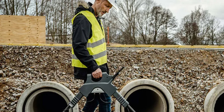
Technical reference image — Calgary
Local considerations
Calgary sits at an elevation of 1,045 m above sea level, with a semi-arid climate that produces very dry surface soils in summer and deep frost penetration in winter — exceeding 1.5 m in some areas. Dry soil is excellent for GPR wave propagation, but the freeze-thaw cycles create a desiccation crack network that can scatter the radar signal and produce false anomalies in the upper 1 m. We mitigate this by collecting data in late spring or early fall when the ground is moist but not frozen, and by applying a 3D migration filter during post-processing. The heavily urbanized core also introduces electromagnetic noise from traffic signals, power lines, and underground metallic conduits, which requires careful filtering and a skilled operator to distinguish real targets from interference.
Pre-excavation scanning to locate water, gas, electrical, and telecom lines down to 4 m depth, using 400 MHz and 900 MHz antennas. Deliverables include a plan-view map of anomalies with estimated depth and size.
02
Geological/Stratigraphic Mapping
Continuous profiling of glacial till, sand lenses, and gravel deposits to guide foundation design. Used in conjunction with our seismic tomography for deeper bedrock mapping.
03
Concrete and Pavement Imaging
Detection of rebar, post-tension cables, and voids in concrete slabs and bridge decks. Per ASTM D4748 for thickness evaluation. Typical applications include parking garages and airport aprons.
04
Environmental and Forensic Surveys
Locating underground storage tanks, buried drums, and landfill boundaries. Also used for assessing historical contamination plumes in industrial areas like the Manchester industrial district.
What is the maximum depth achievable with GPR in Calgary soils?
In the dry sand and gravel that underlies much of Calgary, a 200 MHz antenna can reach depths of 6 to 8 m. In clay-rich glacial till, penetration typically drops to 2–3 m due to higher electrical conductivity. Saturated conditions further reduce range.
How much does a GPR survey cost in Calgary?
For a typical residential or small commercial site, the cost ranges between CA$1,710 and CA$11,280 depending on the survey area, antenna frequency used, and the level of post-processing required. Larger grids with 3D interpretation fall at the higher end.
Can GPR distinguish between different soil types?
GPR primarily measures the dielectric permittivity of the subsurface. Dry sand has a low permittivity (around 4–6) while clay or saturated sand shows much higher values. The signal reflection strength helps differentiate, but we often confirm ambiguous zones with a test pit or cone penetrometer.
Do I need a permit to run a GPR survey on a public street in Calgary?
Yes. The City of Calgary requires a Right-of-Way permit for any non-invasive geophysical survey on public property. We handle the permit application as part of our mobilization, including traffic control plans if lane closures are needed.
How long does a typical GPR survey take?
A standard 30 m by 30 m grid with 1 m line spacing takes about 4 to 6 hours in the field, including setup and data verification. Post-processing and reporting add another 2 to 3 business days.